
MIAMI (AP) - Tropical Storm Imelda formed on Sunday and is predicted to strengthen into a hurricane while following a forecast path that curves away from the U.S. East Coast in the early part of this week. The storm has already caused significant rainfall and rough seas near the Bahamas and Cuba, briefly leading to a tropical storm watch for parts of Florida's Atlantic coast.
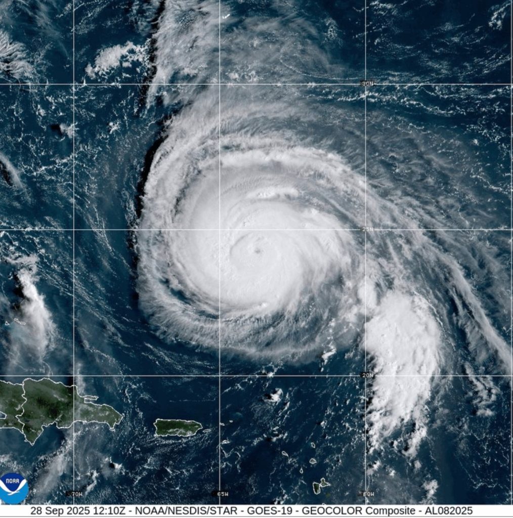
Meanwhile, Hurricane Humberto has slightly weakened but remains a formidable Category 4 storm located further out in the Atlantic, posing a potential threat to Bermuda. In response, the Bermuda Weather Service has issued a tropical storm watch, indicating that tropical storm conditions may affect the island within 48 hours.
As of approximately 8 p.m. EDT, Imelda was positioned around 30 miles (45 kilometers) southeast of the northwest Bahamas and about 355 miles (570 kilometers) southeast of Cape Canaveral in Brevard County, Florida, according to the National Hurricane Center in Miami. The storm is currently moving north at a speed of 9 mph (15 kph) with maximum sustained winds reaching 40 mph (65 kph). Forecasters anticipate that Imelda will traverse across the central and northwestern Bahamas by Sunday night before shifting east-northeast away from the southeastern United States by midweek.
The tropical storm watch for the east coast of Florida, spanning from the Palm Beach-Martin County Line to the Flagler-Volusia County Line, was lifted on Sunday afternoon. However, the hurricane center continues to advise residents along the southeastern U.S. coast to keep a close eye on Imelda’s developments. South Carolina Governor Henry McMaster has also emphasized the need for vigilance, noting that the coastal Georgetown County is returning to normal operations due to an improved forecast. He stated, “What we learn every time is we never know where they are going to go. This storm is deadly serious. Not just serious. Deadly serious.”
Governor McMaster warned that Imelda could bring high winds, heavy rainfall, and flooding to South Carolina, prompting state authorities to position search and rescue teams in preparation over the weekend. In anticipation of possible impacts, North Carolina Governor Josh Stein had already declared a state of emergency before Imelda’s formation.
Hurricane Humberto, which has slightly diminished in strength, continues to be classified as a dangerous Category 4 hurricane, with maximum sustained winds registered at 145 mph (230 kph) accompanied by higher gusts. As of Sunday evening, Humberto was located approximately 450 miles (730 kilometers) south of Bermuda and was advancing northwest at 13 mph (20 kph). The hurricane is expected to turn north within a couple of days before accelerating east-northeast by late Tuesday or early Wednesday. Although Humberto's intensity may vary in the coming days, it is projected to remain a dangerous major hurricane.
In Bermuda and many areas along the U.S. East Coast, dangerous surf conditions are anticipated this week due to Humberto. Coastal residents are advised to be cautious as the storm approaches. Alison Dagostino, who relocated to Myrtle Beach, South Carolina, with her family, shared that after essential storm preparations, daily life in the area remained largely unchanged as locals continued their activities, including enjoying the beach.
As for Imelda, it poses threats of heavy rainfall and flash flooding to parts of Cuba and the Bahamas. Tropical storm warnings are currently in effect for portions of the Bahamas. The Bahamas’ Department of Meteorology has cautioned that moderate to heavy rainfall will persist over the northwestern and central islands, including Nassau, Andros Island, San Salvador, and Long Island. Rainfall totals could range between 6 inches (15 centimeters) and 12 inches (30 centimeters), with isolated areas potentially receiving up to 10 inches (25 centimeters).
Authorities advised residents in low-lying regions to take precautions to protect their property from flooding. On Sunday, storm surge was predicted to elevate water levels by up to three feet (0.9 meters) above normal tide levels along various coastal areas, including the Abaco Islands and Grand Bahama's northern and eastern coasts. The normally bustling streets and beaches of New Providence Island were eerily empty as light, steady rain began flooding roads. Choppy seas and wind gusts deterred both tourists and residents from venturing to popular spots like Potter’s Cay Dock in Nassau. As a result, flights to and from the islands have been canceled, with airports expecting to resume operations once conditions improve.
In Puerto Rico, the National Weather Service warned inexperienced sailors and smaller vessels to avoid hazardous waters, considering swells from Humberto could reach between 7 and 8 feet (2-2.4 meters) in the Atlantic. In the Dominican Republic, where hundreds were evacuated due to adverse weather earlier, meteorologists forecasted only moderate showers, thunderstorms, and gusty winds in some inland regions, leaving areas like the capital, Santo Domingo, to experience merely scattered showers.
In the Pacific Ocean, Tropical Storm Narda, which was previously a hurricane, is rapidly weakening and is expected to transition into a post-tropical storm by Sunday evening or Monday. Currently affecting coastal Mexico and Baja California Sur, forecasters warn of life-threatening surf and rip current conditions along Southern California, although no coastal watches or warnings were issued as of midday Sunday.