
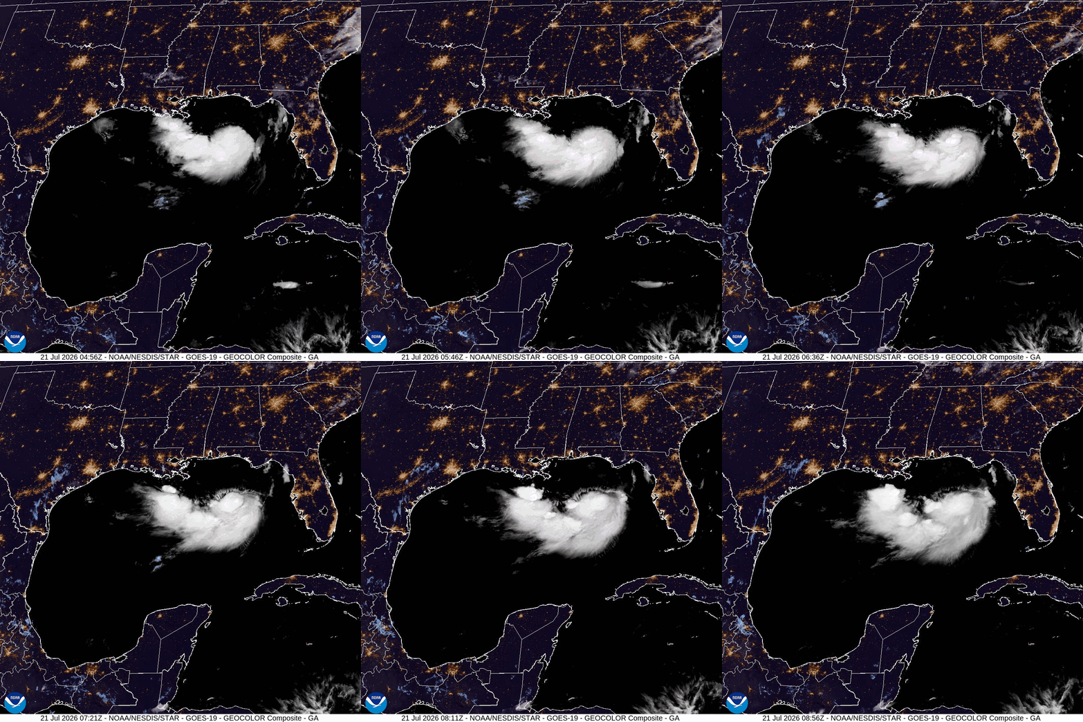
Tropical Storm Bertha intensified in the Gulf of Mexico on Tuesday, but forecasts indicate it will likely weaken as it approaches the U.S. It is expected to bring significant coastal flooding and heavy rain to areas stretching from the Florida Panhandle to Louisiana.
The National Hurricane Center, based in Miami, has issued a tropical storm warning for those areas along the northern Gulf Coast through Wednesday, with potential rain and flooding continuing into Thursday morning. New Orleans was also placed under a tropical storm warning.
As of Tuesday evening, Bertha was located approximately 120 miles (190 kilometers) southwest of Panama City, Florida, and 105 miles (170 kilometers) southeast of Mobile, Alabama. The storm was moving westward at a speed of 6 mph (9 kph) with maximum sustained winds reaching 60 mph (95 kph). Meteorologists anticipate a gradual weakening of the storm from Wednesday through Friday.
Forecasts indicate that Bertha may make landfall on Wednesday night in a sparsely populated area of Louisiana, southeast of New Orleans, according to Michael Buchanan, a meteorologist with the National Weather Service in Louisiana. The primary threat from the storm will be high winds.
In preparation for the storm, authorities in Mississippi, Louisiana, and Florida have opened locations for sandbag distribution to assist residents. Additionally, red flag warnings were issued along certain beaches to alert swimmers about potential rip tide dangers. Along the coast, double red flags indicated that Gulf waters were closed to swimming.
Despite the storm warnings, beaches near Pensacola, Florida, remained mostly empty, except for some tourists taking pictures of the rough surf. Candice Henderson, manager of the Crab Trap restaurant on Perdido Key, noted, “For locals, this is just another storm. When you're on vacation and it’s raining, you either shop or you go out to eat.”
Experts, including Jamie Rhome from the hurricane center, indicated that Bertha is likely to weaken further as it travels along the coastline. There is a possibility that the most severe impacts of the storm will remain offshore.
As Bertha moves into Texas, it is expected to continue weakening. Forecasts predict between 2 to 4 inches (5 to 10 centimeters) of rain from western Florida to the southern Louisiana coastline, with higher totals possible in more isolated areas. This rainfall has the potential to cause flash flooding in urban locations.
Additionally, authorities have warned that communities in Louisiana ranging from the mouth of the Mississippi River to the Alabama-Mississippi state line could experience storm surges as high as 4 feet (1.2 meters), with lesser surges anticipated in parts of Florida and Alabama.
Bertha marks the second tropical storm of the Atlantic hurricane season, following Tropical Storm Arthur, which impacted the southeastern U.S. with heavy rainfall last month.
The National Oceanic and Atmospheric Administration has predicted a below-average Atlantic hurricane season this year; however, this does not completely eliminate the risk of a devastating storm. Bertha could deliver heavy rainfall to coastal areas of Mississippi that are still in recovery mode from the flooding caused by Arthur in June.
Jeff Clark, a spokesperson for Harrison County, Mississippi, noted the heightened attention from residents in light of past flooding, stating, “Because of that, people are definitely paying attention, or at least you would hope so.” As of Tuesday, no shelters have been opened and no evacuation orders have been issued.
In a separate weather update, Hurricane Fausto has been reported churning in the eastern Pacific Ocean, situated far from Mexico’s Baja California peninsula, with no threats to land currently. Fausto attained hurricane status on Monday and was located about 780 miles (1,260 kilometers) southwest of the southern tip of Baja California, exhibiting maximum sustained winds of 75 mph (120 kph) and moving west-northwest at 12 mph (19 kph). While no coastal watches or warnings are active, ocean swells from Fausto may lead to hazardous surf and rip tide conditions along the Baja California coast.