
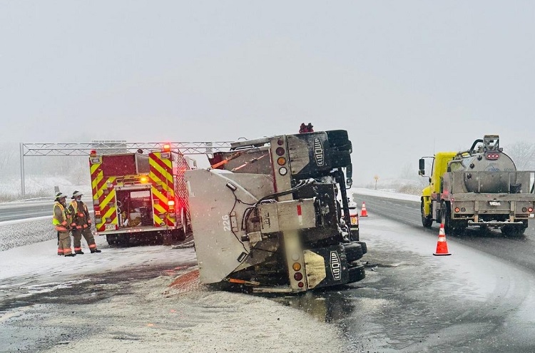
Over 150 crashes have been reported by the Ontario Provincial Police (OPP) in the Greater Toronto and Hamilton Area (GTHA) since early Wednesday morning due to a mix of snow and rain impacting the region. This inclement weather has led to hazardous driving conditions, prompting warnings from authorities for residents to exercise caution.
According to unofficial snowfall totals, Toronto received between 5 to 10 centimeters of snow before the precipitation transitioned to rain, particularly near the lakeshore as temperatures rose. However, meteorologists indicate that this is not the end of the weather challenges for the region. A cold front is expected to push through the Greater Toronto Area (GTA) later in the evening, resulting in increasing winds from the north and a significant drop in temperatures to minus 9 degrees Celsius overnight, accompanied by a wind chill that could feel as cold as minus 17 degrees Celsius.
“Anything that’s wet out there has the potential to turn very icy in the next couple of hours,” cautioned Meteorologist Natasha Ramsahai. The OPP highlighted a particularly busy day for tow trucks and first responders, with extended wait times anticipated for roadside assistance. They advise residents to postpone travel until the weather system has passed, especially for non-essential outings.
The anticipated north winds will also trigger snow squalls north of the city starting Wednesday evening and continuing into Thursday. Regions such as York are expected to experience the most severe effects, with increased chances of school bus cancellations. Areas including Angus, Bradford, and Innisfil are projected to bear the heaviest snowfall, with forecasts suggesting up to 50 centimeters. Newmarket is also at risk of receiving an additional 20 to 35 centimeters of snow.
“Ski hills are happy, drivers will not be,” Ramsahai added, reflecting the mixed sentiments that often accompany winter weather conditions. As the weekend approaches, Toronto could see the coldest air of the season with daytime highs forecasted to reach minus 6 degrees Celsius on Sunday, coupled with an afternoon wind chill that could make it feel like minus 13 degrees Celsius. The current season’s cold conditions began to emerge just days prior when a high of minus 3.3 degrees Celsius was recorded on December 8 at Pearson Airport.
As the situation unfolds, residents are reminded to stay updated on weather forecasts and road conditions. With the potential for hazardous driving conditions continuing, it is essential to prioritize safety during this severe winter weather period.