
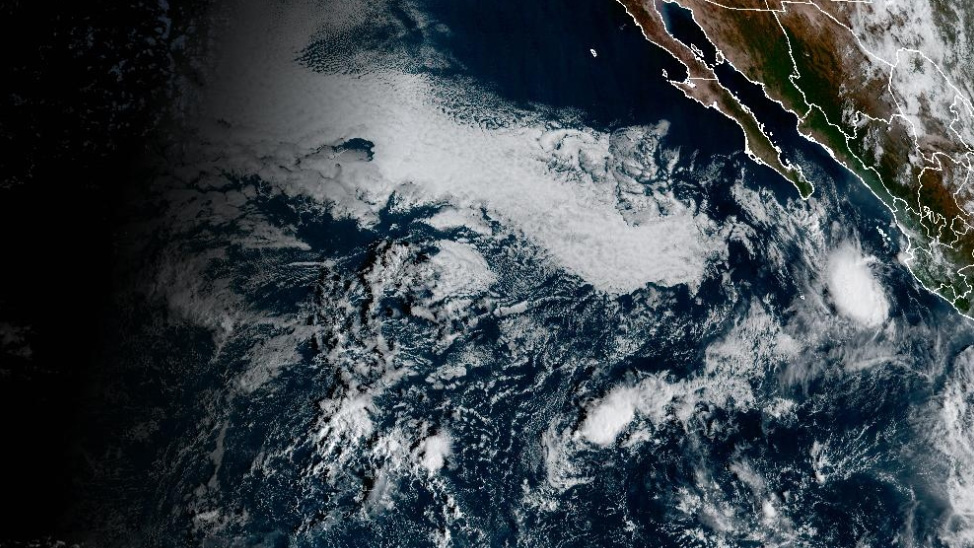
MIAMI (AP) – Hurricane Trudy has intensified as it makes its way toward the Pacific coast of Mexico, with officials reporting significant developments on Thursday.
As of the latest reports, Hurricane Trudy was situated approximately 230 miles (370 kilometers) southwest of Acapulco, Mexico. It is currently exhibiting maximum sustained winds of 105 mph (168.98 kph), as stated by the U.S. National Hurricane Center based in Miami. The hurricane is progressing north-northwest at a speed of 7 mph (11.27 kph) and is anticipated to make landfall along the southwestern and west-central Mexican coast during the upcoming weekend.
The National Hurricane Center has indicated that Trudy is likely to reach major hurricane status by Friday. In addition to its wind strength, the hurricane poses a significant risk of heavy rainfall, with projections estimating that affected areas within Colima and Jalisco states could receive between 4 to 8 inches (101 to 203 millimeters) of rain through the weekend. This influx of rain raises concerns about potential flooding and other weather-related hazards in the region.
In a related weather event, Tropical Storm Champi is also causing concern in the Pacific region. It is located about 750 miles (1,207 kilometers) east of Guam and is moving west-northwest at a pace of 12 mph (19 kph). The National Weather Service has issued typhoon and flood watches for several areas, including Guam, Rota, Tinian, and Saipan, as residents brace for possible impacts from the approaching storm.
As the region prepares for the impending threats from both Hurricane Trudy and Tropical Storm Champi, local authorities are urging residents to take necessary precautions and stay informed about the evolving weather situation. With both storms expected to affect different areas in the Pacific, monitoring updates from official sources will be crucial for safety.
For ongoing updates and coverage regarding severe weather events in Latin America and the Caribbean, readers can follow the AP's dedicated news portal.