
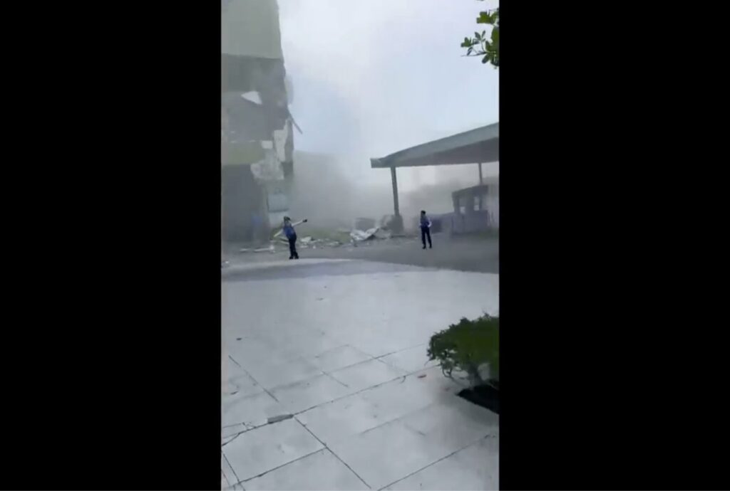
MANILA, Philippines (AP) – An offshore magnitude 7.8 earthquake struck the southern Philippines early Monday, causing significant damage across the region. Affected areas included General Santos, a city with over 700,000 residents and a central hub for tuna processing. The earthquake occurred at 7:37 a.m., with damage reported to buildings and a key access bridge, while a tsunami with waves reaching 1 meter (3 feet) impacted nearby coastal regions. Initial reports confirmed at least four fatalities and over 200 injuries, as emergency officials began assessing the damage.
Philippine President Ferdinand Marcos Jr. urged residents in tsunami-prone areas to evacuate to higher ground. In response, neighboring countries, including Indonesia and Malaysia, issued their own tsunami warnings. The Pacific Tsunami Warning Center announced that the tsunami threat had largely diminished about five hours after the earthquake occurred but advised continued vigilance due to potential fluctuations in sea levels.
The earthquake was the strongest recorded in the Philippines for the year and was centered approximately 13 kilometers (8 miles) southwest of General Santos. Disaster-response agencies were put on high alert, with President Marcos reassuring the public, saying, “The national government is moving and we will not leave Mindanao behind.”
According to Rod Sosmeña, the regional director of the Office of Civil Defense, three fatalities and around 130 injuries were reported directly in General Santos. Several buildings partially collapsed, and critical infrastructure, including a vital bridge, sustained severe damage. In addition, a further casualty was reported in Davao Oriental province as a result of the tremor.
General Santos' international airport was temporarily closed due to the earthquake, leading to the cancellation of 17 domestic flights. Reports also indicated that panic during the event caused injuries among more than 100 students who were attending flag-raising ceremonies in schools throughout the area.
Ednar Dayanghirang, another Office of Civil Defense director from a nearby region, recounted the tremor's intensity, reflecting on his own experience as he struggled to maintain his balance while leaving his residence. DZRH radio station in Manila reported that a small commercial building housing its provincial branch suffered partial collapse, though emergency personnel have yet to ascertain whether anyone was trapped in the rubble.
The Philippine Institute of Volcanology and Seismology stated that the earthquake was caused by tectonic movement within the Cotabato Trench, located 10 kilometers (6.2 miles) deep. The institute’s director, Teresito Bacolcol, remarked, “It’s a major earthquake and we’re expecting damages, and we’ve already seen some damaged buildings based on videos.”
Results from tsunami monitoring stations revealed 1-meter (3-feet) waves reaching provinces like Sultan Kudarat and Sarangani, while Indonesia reported a wave height of 83 centimeters (2.7 feet) off the coast of Sulawesi. Malaysia's Meteorological Department also issued tsunami warnings for Sabah state, given its proximity to the southern Philippines.
The U.S. Geological Survey documented aftershocks measuring up to 6.5 in magnitude, with variations in quake assessments being common shortly after events of this nature. The Philippines, positioned on the Pacific "Ring of Fire," endures frequent seismic activity, volcanic eruptions, and an average of 20 typhoons annually, marking it as one of the world’s most disaster-prone nations.