
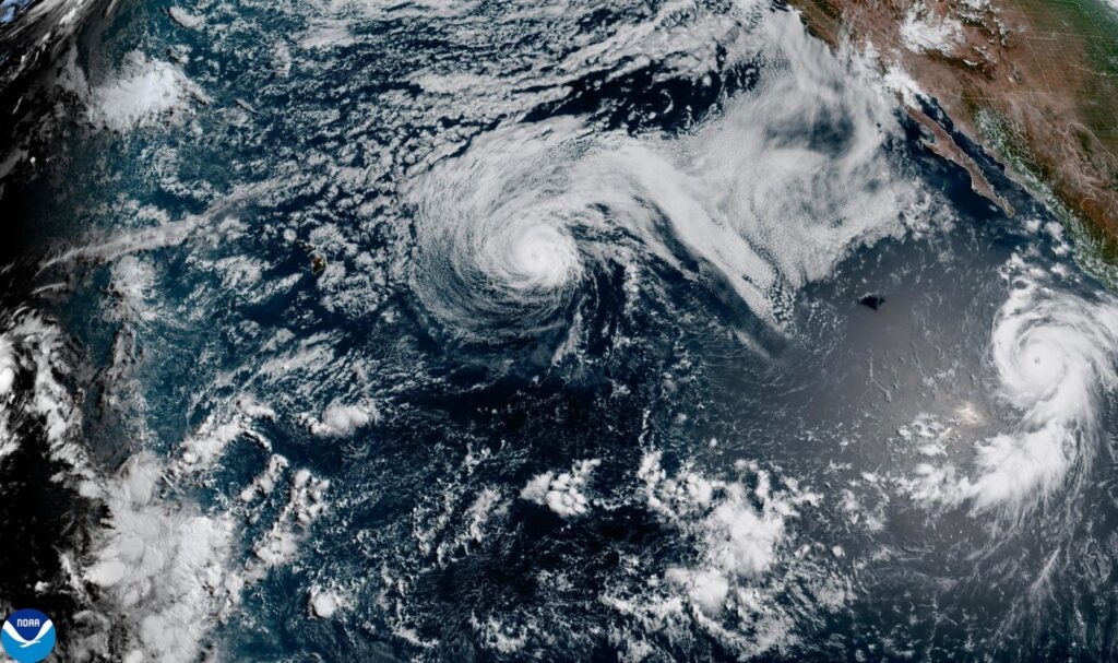
MIAMI (AP) Major Hurricane Genevieve was making significant waves in the Pacific Ocean on Monday evening, occurring simultaneously with the diminishing storm Fausto, which was generating large surf conditions in Hawaii.
Genevieve reached its peak intensity as a Category 5 hurricane early on Monday, marking the first such storm in the East Pacific region in the past two years, as reported by the National Hurricane Center. Fortunately, Genevieve was projected to remain far from land, following a course that runs parallel to the coast of Mexico.
As of Monday, Genevieve showcased maximum sustained winds of 145 mph (230 kph). The center of the hurricane was located approximately 505 miles (810 kilometers) southwest of the southern tip of the Baja California peninsula and was moving northwest at a speed of 12 mph (19 kph).
While there were no coastal watches or warnings active, the hurricane center cautioned that swells generated by Genevieve were likely to produce life-threatening surf and rip current conditions along parts of Mexico’s southwestern coast and the Baja California peninsula. As the week progresses, Genevieve is expected to fluctuate in intensity before eventually weakening.
In the northwest Pacific, Hurricane Fausto was downgraded to a tropical storm by Monday evening as it continued its trajectory towards the Hawaiian Islands. Forecasters indicated that Fausto is anticipated to pass north of Hawaii; however, residents should continue to monitor the storm's development for any potential impacts.
As a result of Fausto's approach, large surf and strong currents were becoming increasingly prominent on east-facing shores of Hawaii’s islands. By Monday, Fausto recorded maximum sustained winds of 70 mph (110 kph). The storm was located about 415 miles (670 kilometers) east-northeast of Hilo, Hawaii, and was traveling west-northwest at a pace of 16 mph (26 kph).
The ongoing situation serves as a reminder of the powerful and unpredictable nature of Pacific storms, particularly during hurricane season.